
Cirrus Clouds
|
Appearance
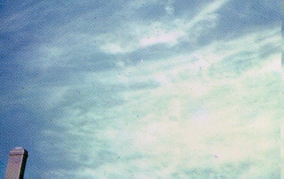
Cirrus clouds are the wispy clouds we see high in the sky. They are usually so thin that you can mostly see through them. You may think of it as little tufts and wisps of soft, white hair on the blue canvas. In fact, "cirrus" is Latin for "ringlet" or "curling lock of hair", classified by scientists.
Height and Formation
Cirrus clouds form over 20,000 feet (6,000 meters) high, wow! Since they form so high in the sky, they don't form from water and dust like the other clouds. In that part of the atmosphere, the temperature is so cold that the clouds are, most of the time, made of ice crystals. But how is there ice in the sky? The temperatures are so cold, that the water freezes into little ice droplets and crystals, forming cirrus clouds. But how cold does it have to be for cirrus clouds to form? Well, in order for cirrus clouds a to form, it has to be -38 degrees Celsius! That's cold!
|
What do they Indicate?
Cirrus clouds indicate bad weather, like snow, rain or thunderstorms. They indicate warm fronts also. So, if you see cirrus clouds, expect some precipitation on it's way!
Odds and Ends for Cirrus
-Since there's much, much, much more wind 20,000 feet in the air, cirrus clouds move the fastest out of all the clouds
-They are sometimes called "the high-leveled clouds" or "Family A" -They mostly move from west to east -Abbreviation is "Ci" -Does not produce precipitation |
cirrostratus clouds
|
Appearance

Cirrostratus clouds looks like sheets of cotton in the sky, but, like their main type, you can see through them. You can see the sun or moon through these clouds because they are so thin. But they can be hard to find, especially at night. So a way to find them is to look at the moon or sun, making a "halo" around them. Those are called "Cirrostratus Nebuloses". If you don't see the halo and the cloud is thicker, then it is a "Cirrostratus Fibratus," though it starts as a nebuloses.
Click the picture to go to it's site. It belongs to Wikipedia. Height
Cirrostratus clouds are 18,000 feet in the air, or 5.5 kilometers.
|
What do they Indicate?
Cirrostratus clouds often mean that there is a heavy amount of moisture in the air, meaning a storm or rain coming, and, like cirrus, they mean a warm front is coming. But there is a way to tell how weak the front is. If the cloud is a "Fragmented Fibratus," then the warm front is weak. After seeing a Cirrostratus cloud, expect rain or some other type of precipitation in the next 12-24 hours or 6-8 hours if it's passing quickly.
Odds and Ends for Cirrostratus
-Cirrostratus has two Latin roots in it -- Cirro, or Cirrus, meaning "curl of hair" and Stratus, meaning "layered."
-In "Family A", meaning "high-leveled" -Does not produce precipitation -Abbreviation is "Cs" |
Cirrocumulus Clouds
|
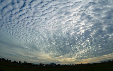
Appearance
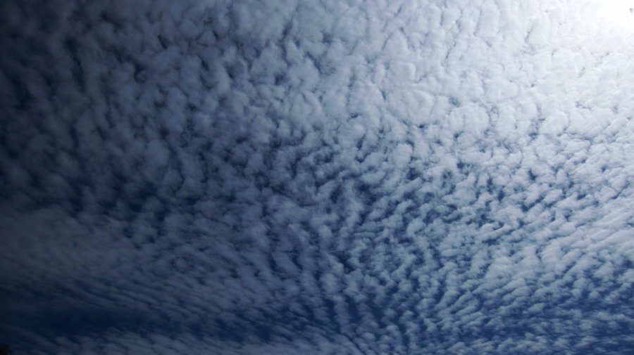
Cirrocumulus clouds appear as white, large, and "patchy" or a tuft and has no grey shadow. You may see them occur in, shall we say, sheets just like in the picture. There are multiple different sheets in the sky when Cirrocumulus occur. You can see through the small tufts, but harder to see the more stuffed together they are, like in the top right corner of the picture. They are sometimes called "herringbone" or "mackerel."
Click on the picture to go to it's site. It belongs to Barrio19 on BzzWords.com Height
Cirrocumulus clouds take place 16,000 feet (5 kilometers) to 39,000 feet (12 kilometers) in the air.
|
What do they Indicate?
Cirrocumulus clouds indicate rain in the near future, usually 8-10 hours from the sight of them.
Odds and Ends for Cirrocumulus
-The Latin roots are Cirro meaning "curl of hair" and Cumulus meaning "heaped."
-In cloud Family A -Does produce precipitation, but is Virga. -Abbreviation is "Cc" |
